
Hazleton Previous Residents by Era
Hazleton address history has several date bands, and each source supplies a different part of the trail. The Recorder is strongest for land transfers. Historical directories and census schedules add dated household clues. Maps help determine whether the building, block, or street arrangement matches the earlier address. Probate and obituary research can provide a responsible endpoint when the historical question no longer needs a current-location claim. Start with the source nearest the date at issue, then use the others to confirm the connection rather than treating one name hit as a complete answer.
| Source | Years It Covers | Where Held | What It Shows |
|---|---|---|---|
| Recorder historic deeds | 1786-1967; first document described as 1787 in the Recorder FAQ | IQS Infodex/E-Film Reader, office books, and Records Facility | Grantor-grantee trail and historic deed books or images. |
| Recorder modern path | 1968-present; indexed images begin December 1980 | Landex Webstore, Landex Remote, and Recorder office | Recent conveyance parties, dates, and document references. |
| LCHS city directories | 1871-2004 | Luzerne County Historical Society | Alphabetical household entries; some volumes have a street index. |
| Federal census | 1790-1950 public schedules | National Archives sources and LCHS indexes | Household details on the census date, not every intervening year. |
| Sanborn maps | Hazleton editions from 1891, 1895, 1909, 1946, and a 1955 revision | Library of Congress and institutional collections | Building, street, and block context, not an occupant list. |
For recent transfers, begin with the parcel and Recorder. For a family-history date, begin with the nearest directory or census and work outward. Previous residents of a Hazleton address need a source date beside every match. A City permit, code, or zoning file can be requested for a specific property and date span, but no online historic permit-by-address database was confirmed.
Hazleton Previous Residents Parcel PIN
The parcel PIN is the bridge between a modern address and older land records. Search the Luzerne County Public GIS Portal by road, municipality, parcel, or address. Its public layers can show parcel geometry, PIN, public owner, assessed values, streets, school districts, structure addresses, and imagery. The map is a starting point. A public owner field is a property-record field, not a list of every person who lived at the address.
Save the municipality, PIN, current address spelling, and legal-description clues before opening a Recorder search. The County says a PIN can control more than one polygon, so a result may highlight several parcels. That makes it important to compare geometry and legal description rather than selecting a record by a similar street number alone. The Assessment Office can provide a property card by counter or defined request when a map view is not enough. A correspondence address on a tax record identifies where a bill was sent, not who occupied the property.
- Parcel PIN
- The County identifier that connects mapping, assessment, and land-record work. Luzerne uses a 17-character PIN in its public GIS parcel search.
- Situs address
- The physical location of the parcel. It may differ from the address used for tax correspondence.
- Legal description
- The recorded land identity, often using lot, block, or metes-and-bounds wording. It can remain stable when a street label is missing or changes.
Hazleton Previous Residents Deed Trail
Recorded ownership is a sequence of conveyances, not a household roster. Begin with the current parcel context and find the acquisition by the relevant party in the Recorder index. Copy the grantor, grantee, recording date, book and page or instrument reference, legal description, and PIN when shown. Next, search the seller as a grantee to find that earlier acquisition. Repeating the party-role switch creates a backward chain. When an older deed lacks a usable street address, the legal description and PIN provide the safer link.
- Locate the address in public GIS and record the municipality, PIN, public owner field, and parcel geometry.
- Search the owner and an approximate transfer date through the Recorder’s current access channel. Capture the deed reference and legal description.
- Search the grantor from that deed as a grantee in the earlier period. Compare the legal description before treating it as the same property.
- Repeat each transfer backward, keeping a dated chain of names, roles, references, and parcel evidence.
- When the modern path ends, use the historic IQS grantor-grantee volumes or request help from the Recorder office or Records Facility.
- Grantor
- The party transferring an interest in a recorded deed.
- Grantee
- The party receiving an interest in that deed. In the next earlier transfer, a later grantor may appear as the earlier grantee.
- Chain of title
- The linked sequence of recorded transfers for a parcel or legal description. It is not a certification of every historical fact.
Note: The Recorder does not conduct individual title searches or give legal advice, so confirm any title question with the appropriate professional or custodian.
Hazleton Previous Residents Deed Access
Luzerne’s historical deed trail uses overlapping channels rather than one uniform online index. The Recorder of Deeds identifies IQS Infodex/E-Film Reader as the free historic route for deeds from 1786 through 1967. Its Grantor/Grantee Index volumes 1 through 5 run from 1786 to August 1, 1993. Landex Webstore makes indices available without charge but charges for document viewing, printing, or downloads. Landex Remote requires a funded account and covers 1968 to present, with indexed images beginning in December 1980.
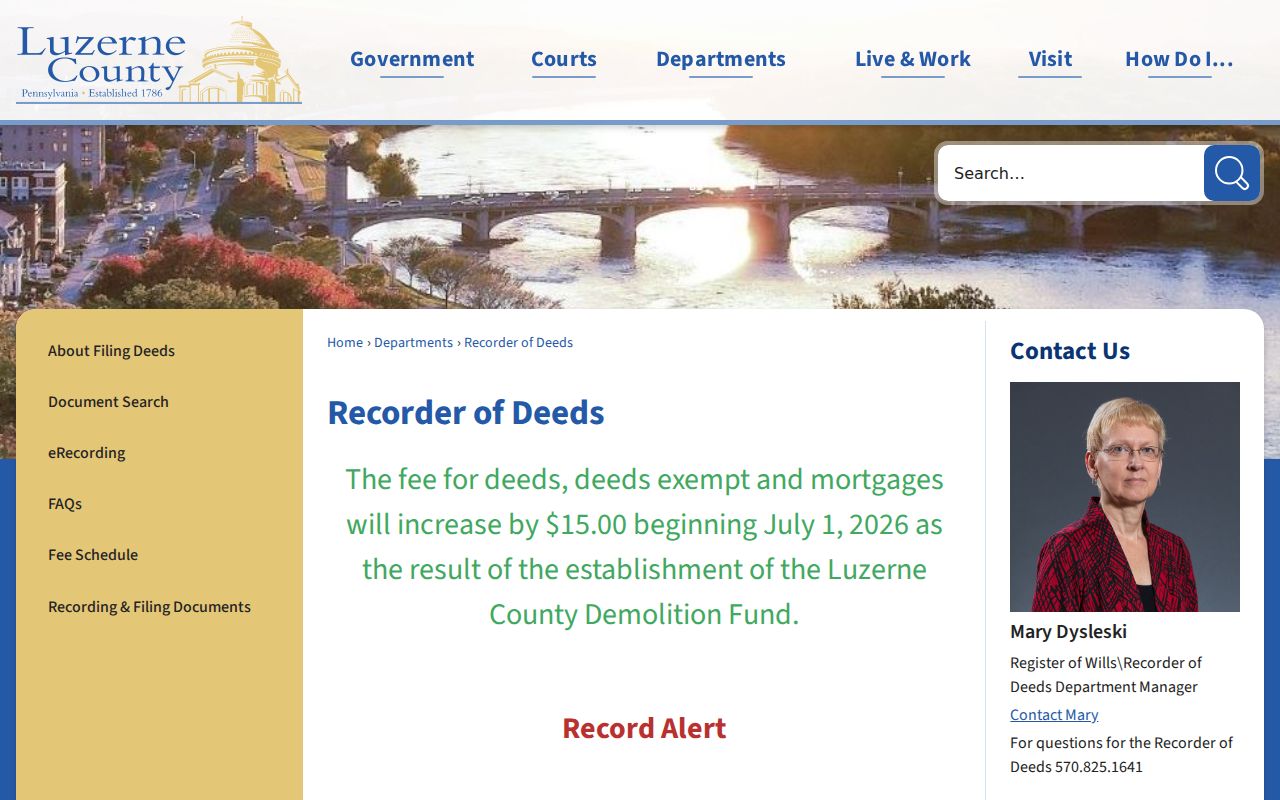
The Recorder access page displays the County’s distinct Landex and IQS routes for historical and newer deed research.
The date bands overlap in useful ways, but they should not be flattened into a single start date. The agency page uses 1786 for the historic index, while the Recorder FAQ calls the first recorded document 1787. Record which source supplies the date. For a needed copy, the office also offers in-person and mailed-copy routes, and older files may require the Records Facility.
On July 1, 2026, the published deed and mortgage fee became $87.75 after a $15 increase supporting the Luzerne County Demolition Fund. The page also lists $0.50 in-office copies or computer printouts per page, mailed copies beginning at $5 for the first page plus $2 per additional page, and $2 certification. Those are dated published fees, not a substitute for checking the current schedule.
Hazleton Directory and Census Pairs
Past residents are best traced by pairing a directory year with the closest census date. The Luzerne County Historical Society reports Hazleton city directories from 1871 through 2004. These alphabetical volumes can include a head of household, spouse, occupation, work address, home address, and widow notation. Some have a street index, but that feature must be confirmed for the exact volume. The Society also holds census indexes, newspapers, maps, surname files, and research-service material.
- Ask for the Hazleton or West Hazleton directory nearest the target year. Copy the name spelling, address, page, and any spouse or widow notation exactly.
- Check the closest earlier or later directory. A move, changed spelling, or revised street name needs a map and parcel comparison before it becomes a new household.
- Pair the directory with the nearest federal census. Public federal schedules now extend through 1950, while a directory can add intervening address and occupation clues.
- Use the Hazleton Area Public Library or LCHS newspaper microfilm for a narrow date and name-variant check. Their runs and indexes are incomplete.
The historical volumes themselves are described in the Hazleton city directories collection. This address trail uses them as a dated household check, not as a replacement for the collection’s holdings research.
Hazleton Previous Residents Map Checks
The Library of Congress Hazleton Sanborn volume has 69 sheets and identifies both Hazleton and West Hazleton in its published notes. Sanborn maps can show building footprints, street names, block layout, and building-use context. They are especially useful when a directory or deed provides a street number but the researcher needs to test whether a later parcel still represents the same physical place.
Use a map as supporting geography only. A map does not prove who lived at a property. Match its date and street form to a deed legal description, parcel evidence, and a directory or census point. LCHS also identifies Hazleton Sanborn editions for 1891, 1895, and 1909, while the broader record trail includes the 1946 volume and 1955 revision.
Hazleton Previous Resident Address Changes
Do not assume a citywide historical renumbering unless a source documents one. The research did confirm recent continuity issues. In July 2025, the City dedicated Ferrara Avenue after a provisional David Avenue name conflicted with an existing David Street for 911 purposes. Ordinance 2026-2 continued Allen Drive and Wilson Street and established Lori Lane, Jordan Street, and Mark Road in Allen Ridge, with map and address-database updates required.
Hazleton’s grid can help check a number that appears mis-keyed. North-south streets number from Board Street, east-west streets number from Wyoming Street, and blocks north of Diamond Avenue begin at 500. For an old address that fails a current map search, keep the printed spelling, compare the municipality, and ask the City or County custodian for the applicable dated record instead of silently converting the address.
Hazleton Previous Residents Endpoints
A well-documented address trail can end in probate, historic vital records, an obituary, or cemetery and church research rather than a current-location claim. The Register of Wills offers estate-index access through IQS for 1875-2004 and handles estate and related Orphans’ Court records. Older Luzerne probate material also has a FamilySearch catalog route for wills from 1787-1916 and indexes from 1787-1918. Adoption is not public, and guardianship access has important limits.
LCHS and the Hazleton Area Public Library provide newspaper and research-service fallbacks. The Standard-Speaker microfilm begins in the early 1900s at the library but is incomplete; LCHS holds early-1800s to 1949 newspaper microfilm, also with incomplete runs. Search a narrow date window, note name variants, and treat a no-result as inconclusive. A death record or estate index can close a historical timeline without implying that every later address is public.
Limits on Past Hazleton Residents
Ownership and household evidence are different. A deed can identify recorded parties, while a directory can list a household at the time of that edition. A match for previous residents does not prove every person associated with the property. The public GIS does not contain a household-member list, direct deed image, mailing address, or deed book and page in its observed free layer. Historic directories are collection- and volume-specific, and no authoritative Hazleton criss-cross run was confirmed.
Protected court, vital, voter, and address records can remain unavailable. A missing result may reflect privacy law, retention, a source’s date range, or a delayed update. Preserve the source and date beside every match, and ask the actual custodian for a defined record when an online index reaches its limit.