
Walking the Hazleton Street Directory
Hazleton street-by-street research is an evidence chain rather than a single list of people. Start with the parcel, then use the county identifiers that connect the map to tax and deed records. A public map can show the parcel's public owner field and assessed-value context. It cannot establish every person at that address. The City records route can supply an identified permit, inspection, code, or zoning file, but no official online permit-by-address database was located. For a past household, a dated directory volume and nearby census or map material provide a different, historical layer.
- Search the free GIS by full address, road, or parcel and record the municipality, parcel geometry, PIN, public owner, and assessed-value context.
- Check the road and directional label against Hazleton's street-numbering rules before treating a similar street name as the same location.
- Use the PIN with Assessment or the Treasurer path for the relevant property or tax record. Keep the situs address separate from any correspondence address.
- Search Recorder channels for the current owner's conveyance, then match the grantor, grantee, date, legal description, and book or instrument reference.
- For a defined historic year, ask the library or historical society whether the appropriate directory volume has a street index, then compare a close census, newspaper, or Sanborn date.
- Request an existing City permit, inspection, code, zoning, or street-name record with the exact property, record category, and date span.
Note: A postal city name alone does not establish jurisdiction, so keep the map municipality and PIN with every address result.
Hazleton Street Grid and Jurisdiction Checks
City Code Chapter 154 supplies useful checks when a number sequence looks wrong. North and south streets, avenues, and alleys number from Board Street, with odd addresses east and even addresses west. Streets north of Diamond Avenue begin at 500. East and west streets number from Wyoming Street, with odd addresses north and even addresses south. The usual 400-foot block has 100 numbers, and the City Engineer assigns the proper number.
Do not use a street name and ZIP alone as proof that a result is inside City limits. Hazleton City and West Hazleton Borough can both have East Shoemaker Street numbers 1 through 100. The County PIN and municipality field resolve that local overlap better than an informal mailing-city label. The code supplies current numbering rules, not evidence of an unverified historic citywide renumbering.
Hazleton Street Directory GIS Controls
Luzerne County's public GIS is the address anchor for a Hazleton street directory. A visitor accepts the portal disclaimer, then can use the central search for a road, municipality, parcel, or address. The Tax Parcels option accepts a 17-character PIN without dashes. A single PIN can control more than one polygon, which explains why a search can highlight several parcels. The free map is designed for map and property context, not a household roster.
| Control | Verified function | Street research use |
|---|---|---|
| Search bar | Finds road, municipality, parcel, or address | Centers the map on the known location |
| Tax Parcels (PIN) | Uses a 17-character PIN without dashes | Links the street address to the county parcel identifier |
| Query | Searches by PIN and highlights matching parcels | Checks whether one PIN controls multiple polygons |
| Layers and Legend | Shows public owner, assessed values, parcel PIN, streets, school districts, imagery, and structure addresses | Compares the road with official map context |
| Measurement and Print | Measures area, distance, or coordinates and creates an output | Records a map observation; County measurements are not engineering grade |
The public map is updated on staggered schedules: assessment-linked data every weeknight, parcel geometry weekly, and street or structure-address points monthly. A deed, assessment card, and map display therefore may not change on the same day.
Hazleton Street Parcel Fields and Limits
The inspected public parcel layer exposes GIS PIN, PIN, long PIN, municipal code and name, export date, public owner, care-of, and land, building, and total assessed-value fields. That is enough to connect a street location to a county parcel and a public ownership field. It is not an observed free-layer list of household members, a mailing address, a deed image, a deed book or page, or a direct certificate.
The subscription GIS has a broader access tier. It adds owner mailing address, deed book or page, deeded acreage, zoning, flood and soil layers, multiple aerial years, and parcel or notification-radius tools. The County lists 24-hour, 30-day, and annual subscription rates. Those added fields are a paid county mapping channel, not evidence that anyone occupies an address. A correspondence route for a bill should not be treated as a physical-location claim.
Hazleton Street Tax and Assessment Route
The Treasurer's online form is a confirmed Luzerne County route for a street directory search when a name, address, or parcel identifier is already known. It asks for at least one value and advises that fewer details produce more matches. The Assessment Office maintains parcel information and the Uniform Parcel Identifier, while the Treasurer provides the tax search and certification route. A tax-account result should be checked against the parcel and deed chain, because owner, parcel, situs, and correspondence recipient can be different people or locations.
Luzerne County's Treasurer tax search supplies the address, name, and parcel form used for this route.
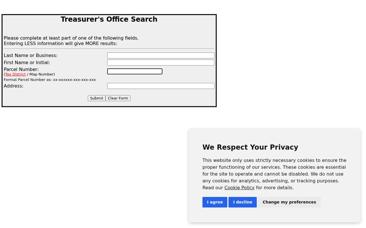
The form is useful for narrowing a known property record. The research did not capture result pagination, export behavior, or a sample tax-result card, so those details should not be assumed from the search screen.
| Tax-search field | Verified input |
|---|---|
| Last Name or Business | Full or partial name or business term; at least one search value is required. |
| First Name or Initial | Optional narrowing term. |
| Parcel Number | Tax District / Map Number in the County's displayed parcel format. |
| Address | Address associated with the tax record. |
A property card is $1 per page at the Assessment counter. The published remote charge is $4 for a residential card and $6 for a commercial card, with the PIN and payment requested. A tax certification is $10 per parcel per year, and a duplicate bill is $10.
Hazleton Records Searchable by Street
Address-keyed records tell different parts of a street story. Start with the free GIS and move only to the next custodian that can answer the remaining question. The Recorder can connect a parcel to recorded parties and a legal description. A City zoning or permit file can be relevant only when an identifiable existing file is requested. The election Street List is a controlled County product, not a public web view. Historical directories are date and volume specific.
| Address record | Keeper | What it can show | Access reality |
|---|---|---|---|
| Public parcel GIS | Luzerne GIS | Parcel, PIN, public owner, values, and street-map context | Free web map; public owner is not a full household list |
| Assessment card | Assessment Office | Property and assessment record tied to a PIN | Counter or defined request; full free interface was not verified |
| Treasurer tax search | Luzerne Treasurer | Name, parcel, or address tax-account route | Web search and paid certification; correspondence is not occupancy proof |
| Recorded deed index | Recorder of Deeds | Recorded parties, dates, legal description, and document reference | Historic and modern channels differ; an address can be absent |
| Permit, code, or zoning file | Hazleton City offices | Existing application, inspection, complaint, certificate, or decision record | Defined written request; no online address-indexed search was located |
| County Street List | Bureau of Elections | Permitted voter-list fields by address or street | Written form, ID, certification, fee, and protected-voter limits |
| Historical street index | LCHS or Hazleton Area Public Library | Listed householder, address, and occupation in that edition | Confirm the directory year and whether its volume has an index |
Note: A geographic map search, tax account, deed party, and directory entry are distinct record facts that should be compared, not merged into one claim about a household.
Hazleton Street Directory Deed Trail
Once a parcel PIN and a public owner clue are in hand, the Luzerne County Recorder of Deeds routes the property into a recorded conveyance trail. Landex Remote provides funded-account access from 1968 forward, with indexed images from December 1980. Landex Webstore provides free indices and paid view, download, or print access. IQS Infodex and E-Film Reader offer free historic deed searching from 1786 through 1967. Grantor-grantee index volumes 1 through 5 span 1786 to August 1, 1993.
Find the current owner's acquisition, capture the party roles, recording date, legal description, and book or instrument placement, then search the seller as an earlier grantee. When the modern index period ends, change to the historic grantor-grantee books. The Recorder cautions that a deed does not always contain the full property street address. Legal description, lot or block wording, and the PIN are stronger connectors than a street number alone.
In-office copies or computer printouts cost $0.50 per page. Mailed copies begin at $5 for the first page plus $2 per additional page, and certification is $2. The Recorder does not conduct individual title searches or provide legal advice.
Hazleton City Files for an Address
Hazleton zoning, code, planning, permit, and inspection materials can hold defined address evidence. The zoning officer maintains application, permit, certificate, complaint, enforcement, investigation, and decision records subject to Right-to-Know limits. A particular zoning application may identify an applicant or owner, property location, adjoining landowners, proposed structures, access, and utilities. It is not a street-wide names database.
Use the City Open Records route for an existing, narrow request such as a final zoning permit, certificate of occupancy, or final code-enforcement notice for one address during a stated period. The City accepts written requests by email, fax, mail, or hand delivery, and requires enough detail to find an existing file. No public online permit-by-address or code-case result database was confirmed. City Open Records publishes a five-business-day response baseline under the Pennsylvania Right-to-Know Law.
Hazleton Voter Street List Route
The state voter-status service is designed for an individual's own registration verification. It is not a by-street browser. Luzerne County's Request for Public Voter Files form is the documented street route. The form offers Street List, Walking List, Public Information Voter Listing, Voter Export, and absentee or mail-ballot listing options, with paper, USB, or email delivery choices where offered. It requires requester identification and an attested use statement.
A Street List can contain name, residence address, mailing address, party, and active or inactive status. The County restricts public-list use to election, political-activity, or law-enforcement purposes under the cited election rules. Protected voters are excluded. Printed reports cost $0.25 per page and electronic reports cost $20. The individual service and County list process should never be used to infer ballot selections.
Hazleton Street Name Updates Matter
Street research has a current-date problem. In July 2025, the City dedicated Ferrara Avenue after a provisional David Avenue conflicted with an existing David Street for 911 purposes. Ordinance 2026-2 added or continued Allen Drive and Wilson Street and established Lori Lane, Jordan Street, and Mark Road in Allen Ridge. The ordinances call for map, record, and address-database updates and notifications to Recorder and emergency services.
Check the current official spelling and the date range before rejecting a historical permit, map, or directory entry. A June 2026 County GIS technical-difficulties notice is another reason a failed map lookup should lead to a retry or desk contact, not a negative conclusion.
Past Hazleton Street Listings
For a dated street question, printed directory holdings are more useful than trying to force a current property source backward. The Luzerne County Historical Society reports Hazleton city directories from 1871 through 2004, plus maps, census indexes, newspapers, and surname files. Ask whether a particular volume includes a street index. Pair a listing with the closest census, Sanborn, newspaper, probate, or deed date because a volume may describe the prior year.
The detailed collection trail is maintained in the Hazleton city directories collection. Sanborn maps help identify building and block context, but they do not establish who lived at a property.
Hazleton Street Directory Privacy Limits
A Hazleton street directory can connect a mapped parcel with public ownership, recorded-party, or historical-directory information. It cannot reliably show every current occupant, a complete household, utility or delivery data, state driver or vehicle data, or protected address participants. The public GIS owner field is a property-record field. Court systems also suppress sealed, expunged, limited-access, Clean Slate, juvenile, and other protected matters.
Pennsylvania's Address Confidentiality Program provides a substitute mailing address for qualifying participants in certain public systems. Voter files exclude protected voters, and PennDOT data follow separate privacy restrictions. A missing name may reflect those rules, retention, scope, or a data-update lag. It is not reliable proof that nobody is tied to an address.